historic cross-sections
Historic PSAAPG Cross-sections List
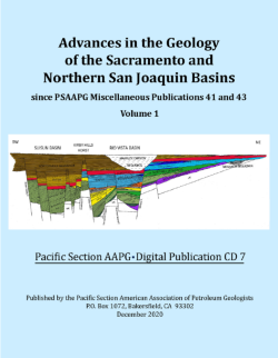
Below is a list of cross-sections that have appeared on PSAAPG price lists over the years. Many of these sections are available only on our DVD #6, which is available for purchase at the bargain price of $145.00. A table of contents for this DVD can be viewed by clicking here. Many of these cross-sections can also be purchased individually from AAPG Datapages.
| Cross-sections |
|||
| ID | TITLE | YEAR | STATUS |
| CS 1 | Mt. Diablo to East Side Sacramento Valley – South (2 Sheets) | 1951 | out of print |
| CS 2 | Eastern Ventura Basin | 1952 | out of print |
| CS 3 | Los Angeles Basin-Paloe Verdes Hills to San Gabriel Mountains | 1952 | out of print |
| CS 3R | L. A. Basin: (Palos Verdes to the San Gabriel Mtns) | 1988 | |
| CS 4 | Salinas Valley (1 Sheet) | 1952 | out of print |
| CS 5 | Western Ventura Basin, Pt. Conception to Channel Islands (2 sheets) | out of print | |
| CS 6 | Sacramento Valley North from T23N/R1W to T16N/R1E (2 sheets) | 1954 | |
| CS 7 | Ventura Basin-Central from T5N/R23W to T1SR21W (Santa Ynez Fault North of Ojai to Western Santa Monica Mountains) | 1956 | |
| CS 8 | San Joaquin Valley – South (1 sheet) | 1957 | out of print |
| CS 8R | Revised Southern San Joaquin Valley from the San Andreas Fault to the Sierra Nevada Foothills | 1986 | |
| CS 9 | San Joaquin Valley Central from T21S/R12E to T15S/R23E (San Andreas Fault to Sierra Nevada Foothills) | 1957 | |
| CS 10N | San Joaquin Valley Central from T4N/R3E to T18S/R20E (Rio Vista through Riverdale) | 1958 | |
| CS 10S | San Joaquin Valley Central from T18S/R20E to T10N/R19W (Riverdale through Tejon Ranch Area) | 1958 | |
| CS 11 | San Joaquin Valley, West Side from T19S/R15E, MD B&M, to T8N/R23W, SB B&M (Coalinga to Midway Sunset and across the San Andreas Fault into Southeast Cuyama Valley) | 1959 | DVD #6 |
| CS 12 | Santa Maria Basin from T11N/R34W to T5N/R34W (from Cretaceous outcrop in Santa Ynez Mountains to Franciscan outcrop North of Santa Maria River) | 1957 | |
| CS 13 | Sacramento Valley, North-South from T29N/R2W to T3N/R2E (Red Bluff to Rio Vista) | 1960 | |
| CS 14 | L. A. Basin from T15S/R15W to T8S/R10W (Beverly Hills to Newport) | 1962 | |
| CS 14R | L. A. Basin (2 sheets – Santa Monica Mountains to Seal Beach; Seal Beach to Newport-San Joaquin Hills) | 1987 | |
| CS 15 | Sacramento Valley Central from T4N/R1W to T4N/R7E (Suisun Bay to Lodi) | 1967 | |
| CS 16 | Southern Sacramento-Northern San Joaquin Valley from T3S/R10E to T8N/R1E: 1967 (Winters to Modesto) | 1967 | |
| CS 17 | San Joaquin Valley: T16S/R10E to T8N/R1E (Kingsburg to Tejon Hills) | 1969 | |
| CS 18 | Geological Section: Upper Cook Inlet | 1967 | out of print |
| CS 19 | Cook Inlet Basin Stratigraphic Study (5 sheets) | 1969 | out of print |
| CS 20 | Lower Susitna-Knik Area Stratigraphic Sections (2 Sheets) | 1970 | out of print |
| CS 21 | Copper River Bsin Stratigraphic Sections (2 Sheets) | 1970 | out of print |
| CS 22 | North Slope Stratigraphic Section | 1971 | out of print |
| CS 23 | North Slope Stratigraphic Section – Prudhoe Bay to Ignek Valley | 1972 | out of print |
| CS 24 | Correlation Section of NW Oregon (Astoria to Eugene) | 1984 | |
| CS 25 | San Joaquin Valley from T16S/R21E to T11N/R18W | 1987 | |
| CS 26 | Cuyama Valley | 1987 | |
| CS 27 | San Joaquin Valley, Cantua Creek to Transverse Ranges: T11N/R21W to T17S/R15E (Fresno, King & Kern Counties) by D. Sprouse (ed.) | 1989 | |
| CS 28 | Northern L. A. Basin (From Santa Monica Bay to Prado Flood Control Basin) by J. C. West and T. W. Redin (eds.) | 1990 | |
| CS 29 | Eastern L. A. Basin (from San Pedro Bay to San Gabriel Mts.) by J. C. West and T. W. Redin (eds.) | 1991 | |
| CS 30 | Central Ventura Basin from T5N/R19W to T1N/R18W by T. Hopps, H. Stark, R. Hindle, J. Thompson & G. Brown (eds.) | 1995 | |
| CS 31 | Sacramento Valley from T13N/R5W to T15N/R4E by R. Suchsland, J. Clare, W. Edmondson, R. Boyd, & F. Cressy (eds.) | 1995 | |
| CS32 to CS42 | Santa Barbara Channel Cross Section Montages (includes cross-sections CS 32 to CS 42) | ||
| |
|||
| Cross-sections – San Andreas Fault (1964) |
|||
| ID | TITLE | YEAR | STATUS |
| SA 1 | Pacific Ocean to the Gulf of Farallones | 1964 | |
| SA 2 | Gulf of Farallones to Bielwaski Mt. | 1964 | |
| SA 3 | Bielwaski Mt. to Hollister | 1964 | |
| SA 4 | Hollister to Bitterwater Valley | 1964 | |
| SA 5 | Bitterwater Valley to Parkfield | 1964 | |
| SA 6 | Parkfield to Soda Lake | 1964 | |
| SA 7 | Soda Lake to Santiago Creek | 1964 | |
| SA 8 | Santiago Creek to Sawmill Mt. | 1964 | |
| SA 9 | Sawmill Mt. to Valyermo | 1964 | |
| SA 10 | Valyermo to the Mexican Border (includes segments 10 – 12) | 1964 | |
| SA 11 | San Andreas Composite (Summary of segments 1 to 12) | 1964 | |
| |
|||